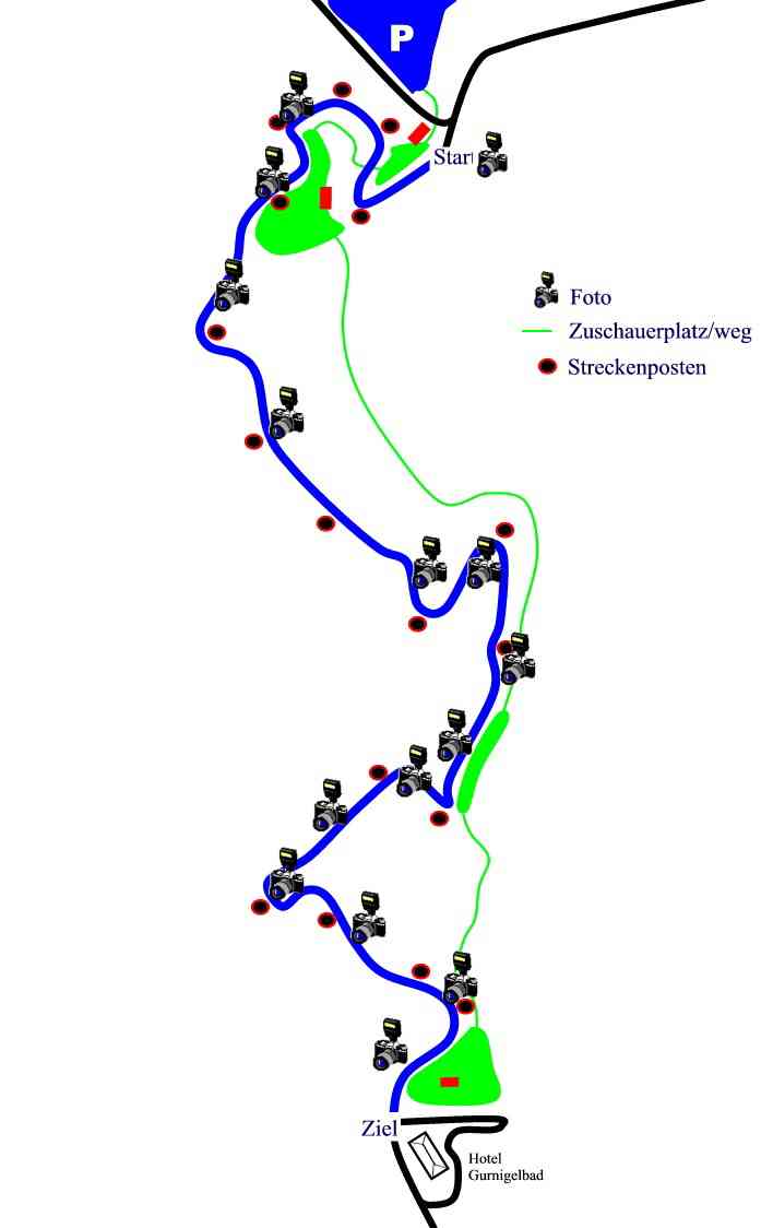
A 5.000 km climb which climbed through 253m at an average gradient of 5.07%. It was used in 1927 and 1930.

A 7.70 km hillclimb used in 1913. It is located to the north-west of Lausanne.

First used on 1911, the above map is from 1924.

First used in 1910, on a 4400m course which climbed through 298m over an average gradient of 7%, with a maximum gradient of 15%. A 9000m course was used between 1925 and 1931 which climbed through 776m over an average gradient of 7%, again with a maximum gradient of 15%.
János Hegy, Hungary
Held between 1925 (for motorbikes only) and 1930 on a 7.4 km course. A
4.6 km was used after 1930.

A 6.0 km climb near Bern, first used in 1912. This map is from 1932.

A 21.5 km climb in the Linthal valley, it climbs through 1300 metres. It was used in the 1930s, although it reopened in 1993 and 1998 for historic recreations.

Located in the south of switzerland, it was used only once on the 23rd September 1938.

A 6.1 km hillclimb to the north-east of Lausanne, used on the 14th October 1906. A new 9.300 km climb over the Jura Pass was used in 1909 and 1911.

A 5.96 km hillclimb first used in 1908. It climbed through 604m at an average gradient of 10% (maximum of 15%) to a total altitude of 1054m. The above map is from 1924.

A 6.5 km climb used from 1910. The above map is from 1925.

Located near Graz, Riesberg was first used in 1907 as a 6 km hillclimb. By 1926 this had been shortened to 5km, which is what is shown in the map above.

Used from 1899-1933, this 10.000 km course climbed through 418m at an average gradient of 10.4%.

A 5.077 km course first used in 1924. It climbs through 305m.

A 9.850 km long course which climbed through 634m with a maximum gradient of 10% (an average of 6.44%). It was used at least in 1939 and 1948.


